History of Settlement of South Australia
"Land, capital and labour are the three grand elements of wealth; and the art of colonization consists in transferring capital and labour from countries where they are in excessive proportion to the quantity of fertile land, to countries where there is plenty of fertile land, but neither capital nor labour."-
John Stephens - The History of the Rise and Progress of the New British Province of South Australia 1839, which can be read in full or downloaded here.
These maps are part of a more detailed and informative page, which can be visited here. [Opens in a new tab.]
Click/tap on the years listed below to see the progression of settlement.
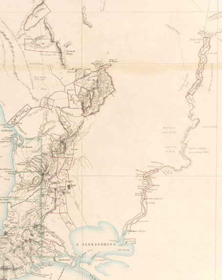
Extract from a map compiled by N B Tindale of the South Australian Museum, showing Aboriginal tribal areas.

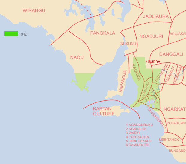

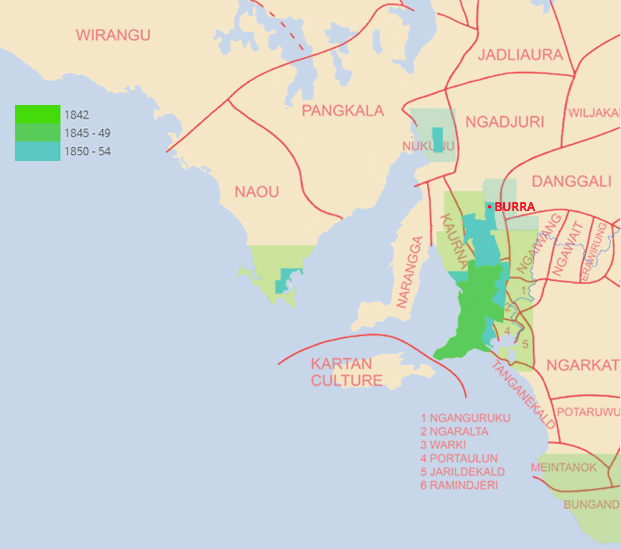
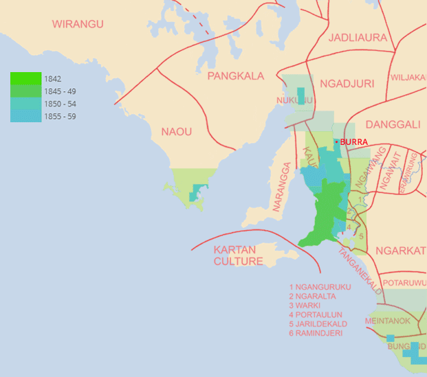
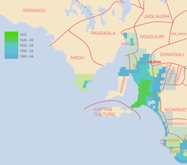
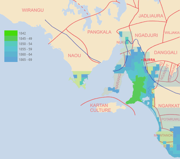


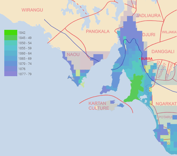


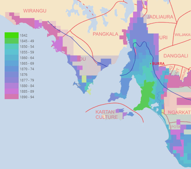


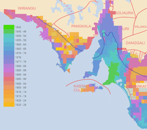

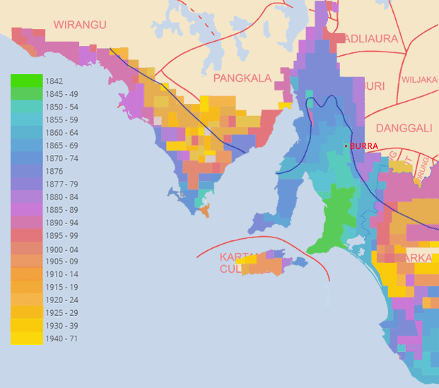
From the beginning of settlement the 'vacant', so-called Waste Lands of the whole of South Australia were leased to Pastoralists (graziers) under a progression of Parliamentary Acts. Title to those Pastoral Holdings remained with the Crown.
From 1836, smaller areas of land were surveyed into Counties, which are shown here as semi-transparent areas; then subdivided into Hundreds, areas of approximately 100 square miles (259 square kilometers and shown here in solid colour). Those Hundreds were then subdivided into Sections which were either sold by auction in South Australia or pre-sold in Britain as town or agricultural (cropping) blocks. Title to the land passed from the Crown to the purchaser, and any pre-existing Pastoral Lease over the land was terminated.
The Special Surveys, including the Mine Survey are too small to be shown on the map.
Goyder's Line (surveyed 1866) is shown from 1865-69 onwards.